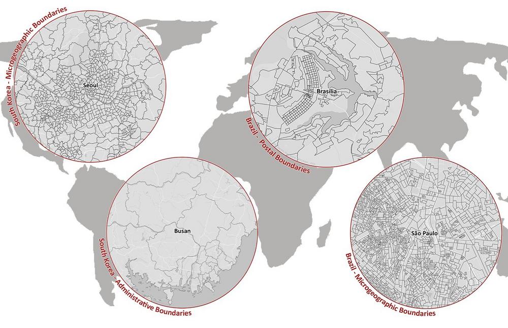
In today’s highly interconnected world, accurate and up-to-date data is crucial for businesses operating across borders. Recognizing this need, MBI is proud to announce the release of its latest global boundaries data, offering significant enhancements for companies with a global presence. With their comprehensive global digital boundaries for more than 248 countries across over 1,000 geographic levels worldwide, MBI offers businesses unparalleled insights into market dynamics at a granular level.
New Features and Enhancements
In this latest release, MBI introduces several new features and enhancements aimed at providing more accurate and detailed geographic information:
New Administrative & Postcode Levels: The database now includes new administrative levels for various countries, such as Districts in the United Arab Emirates, Srok in Cambodia, and Corregimientos in Panama. It also covers new postcode levels, such as postcodes 6 and 4 for Cambodia, postcodes 5 for Mongolia, and postcodes 2 for the Cayman Islands, among others.
Key Changes: MBI has updated key changes of administrative divisions for several countries, including Azerbaijan, Bhutan, Indonesia, Jordan, North Korea, Kuwait, Kazakhstan, the Philippines, Pakistan, the Northern Mariana Islands, New Zealand, and the United States Minor Outlying Islands, ensuring alignment with the latest administrative structures.
Expanded Coverage: With new areas added, including administrative and/or postal boundaries for countries like the United States of America, New Zealand, the United Kingdom, the Netherlands, Portugal, Sweden, Israel, Mexico, Brazil, Russia, the United Arab Emirates, India, Mongolia, Cambodia, the Philippines, Pakistan, and Panama, MBI’s dataset now offers even broader coverage, empowering businesses with comprehensive global insights.
Worldwide Availability and Benefits
MBI’s digital boundaries serve as a valuable resource for businesses across various industries, offering many key benefits:
- Extensive Coverage: With one of the largest inventories of administrative, postal, and microgeographic boundaries, MBI provides businesses with diverse datasets to meet their specific needs.
- Accuracy: MBI’s data layers are topologically correct and seamlessly integrated with neighboring countries, ensuring the highest level of accuracy.
- Regular Updates: All boundaries undergo strict quality control and are regularly updated to reflect the latest changes, ensuring up-to-date and reliable information.
- Easy Integration: Compatible with all standard GIS formats, including ESRI Shapefile (.shp), ESRI File GeoDataBase (.gdb), MapInfo TAB Extended (.tab), GeoJSON (*.geojson), and GeoPackage (*.gpkg), MBI’s digital boundaries facilitate seamless integration into existing systems.
Unlocking Opportunities with the 2024 Release
"Our 2024 global boundaries release provides businesses with the latest, most comprehensive, and highest quality geographic data for countries around the world," said Ray Roberts-York, Managing Director at MBI. "Having accurate geospatial intelligence is empowering businesses with the insights they need to thrive in today’s competitive environment."
The updated global boundaries enable businesses across industries like logistics, retail, marketing, and more to better visualize their markets, implement strategies, plan locations, and conduct geographic analysis on a local or global scale.
For further details regarding the geographical levels available in individual countries, MBI’s competitive package prices for the complete world dataset, or specific information about countries relevant to your operations, please reach out. Our Sales Team will be delighted to assist you in maximizing the value of MBI’s global digital boundaries for your business needs.
Being a specialist for small-scale data for Geomarketing, Michael Bauer International has grown to one of the largest global data providers for over ten years. MBI unites passion and scientific know-how to provide globally consistent and comparable geographic, market and risk data.
Today MBI is not only recognized as a key data source but is also the preferred data provider for the largest leading GIS software and technology companies globally. For a vast variety of companies, MBI’s data is the foundation for location-based questions related to company locations as well as branch and distribution networks. MBI mobile data offers valuable insights into the global consumer behavior and their customer journey. Companies from all industries are supplied with up-to-date data for market analyses and visualization by MBI, to take informed and data-based decisions.
With CONIAS Risk Intelligence, we provide in-depth and data-driven information about the current and emerging dynamics of political conflicts worldwide. We support internationally operating companies and organizations in identifying political risks to location, logistics and investment security at an early stage and in developing targeted adaptation strategies.
MBI is one of the first global HERE Technologies Distributors as well as “Global HERE Distributor of the Year 2023”. HERE is the leading provider in the development of digital maps and location-based services.
Both Michael Bauer Research GmbH and Michael Bauer Micromarketing GmbH are part of the Michael Bauer Group.
For more information, please visit www.mbi-geodata.com.
Michael Bauer International GmbH
Greschbachstr. 12
76229 Karlsruhe
Telefon: +49 (721) 1618566
Telefax: +49 (721) 94540496
http://www.mbi-geodata.de
Head of Marketing
Telefon: +49(0)721-46470339
E-Mail: jessica.hablowetz@mbi-geodata.com
![]()

